Maui sits in the middle of a cluster of islands, Maui Nui, with sheltered channels between them. That makes it the easiest place in Hawaii to combine calm shore snorkeling with a boat day to a sunken crater or a lava cathedral. Here are 17 sites around Maui, Lānaʻi and Molokaʻi on one map.
Where are the best snorkel and dive sites on Maui?
Most of the action is on Maui's sheltered south coast, from Kīhei to Mākena, where the reef runs right up to the beach and Molokini sits a short boat ride offshore. West Maui has calm bays in Kāʻanapali and Kapalua. Across the channels, Lānaʻi has some of the most famous dives in Hawaii, and the far east tip of Molokaʻi is a wild, advanced site for experienced divers.
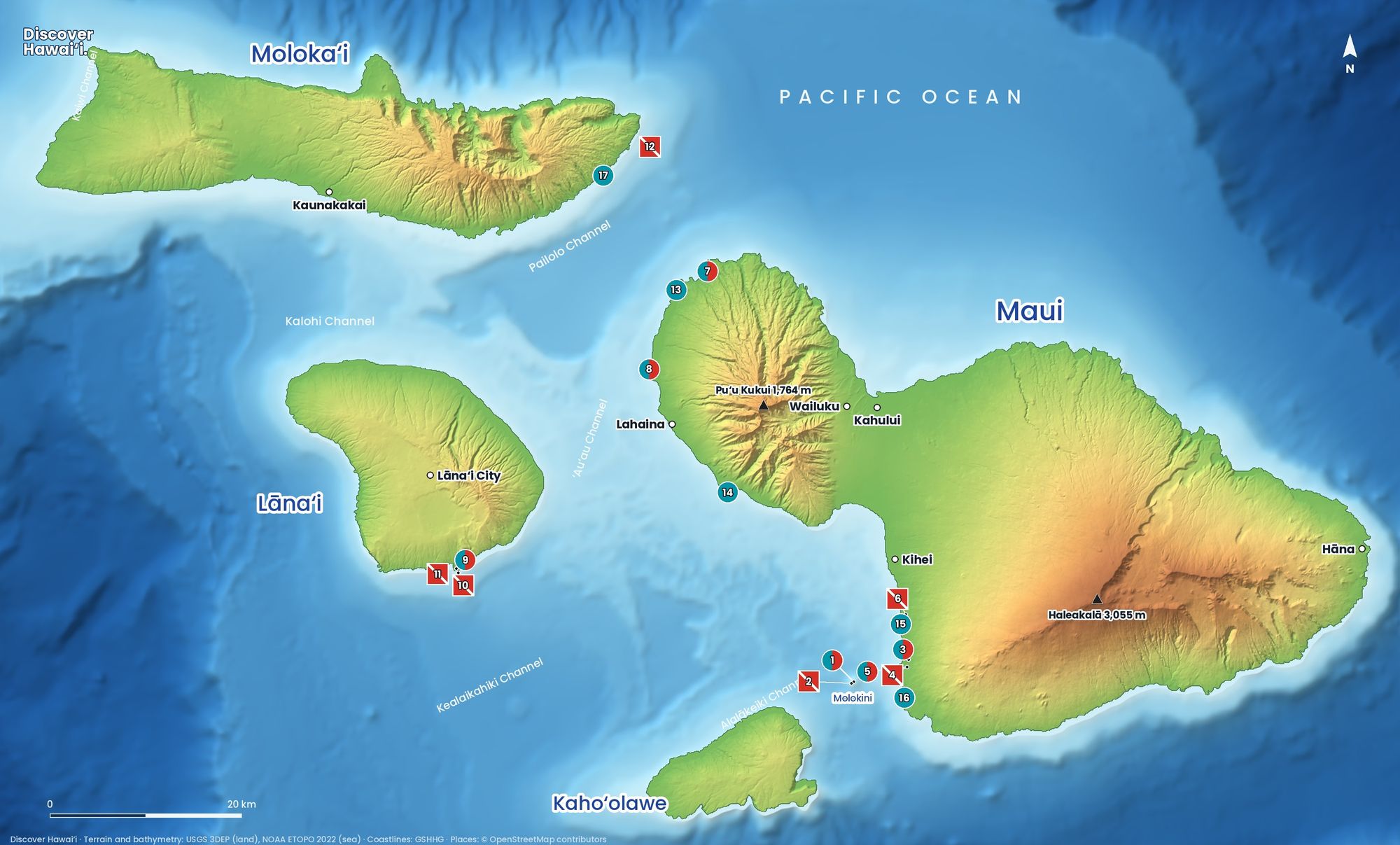
- Molokini Crater (inside)Boat · beginner A crescent-shaped crater and Marine Life Conservation District with up to 150-foot visibility.
- Molokini Back WallBoat · advanced A sheer wall dropping more than 250 feet into the blue.
- Mākena LandingShore · beginner Easy entry, turtles, lava fingers and small caves.
- Five Graves (Five Caves)Shore · intermediate Lava arches and caverns with turtles and whitetip reef sharks.
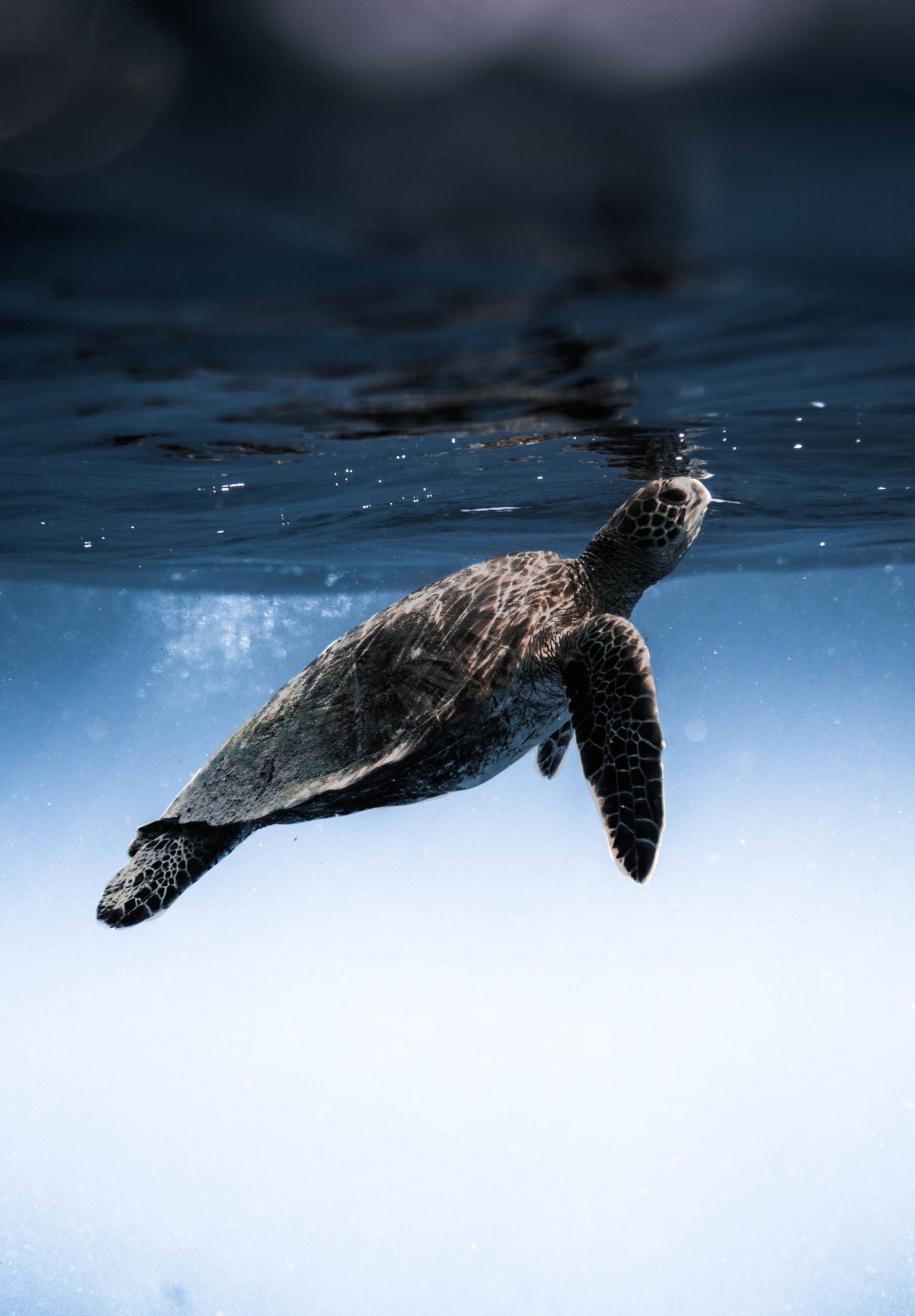
- Turtle Town (Maluaka, Mākena)Boat · beginner A lava-rock reef famous for green sea turtles.
- St. Anthony Wreck (Keawakapu Reef)Boat · intermediate A sunken longliner on an artificial reef, with frogfish and eels.
- Honolua BayShore · beginner A Marine Life Conservation District with rich coral and turtles.
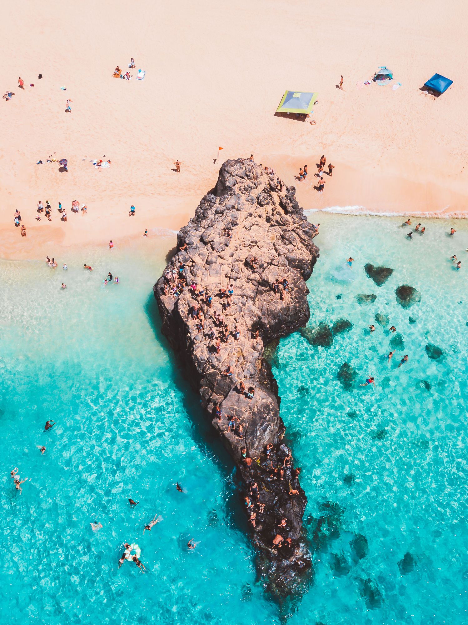
- Black Rock (Puʻu Kekaʻa), KāʻanapaliShore · beginner A sacred lava point with turtles and cliff divers.
- Hulopoʻe Bay, LānaʻiShore · beginner A protected bay where spinner dolphins often rest.
- Cathedrals I & II, LānaʻiBoat · intermediate Light-beamed lava chambers, Hawaii's most iconic dive.
- Sergeant Major Reef, LānaʻiBoat · intermediate Lava ridges and an arch with nesting sergeant majors.
- Mokuhoʻoniki Islet, MolokaʻiBoat · advanced Hammerhead sharks and strong currents off east Molokaʻi.
- Kapalua BayShore · beginner A calm crescent bay between two lava points.
- Olowalu (Mile Marker 14)Shore · intermediate A vast, ancient coral reef with turtle cleaning stations.
- Ulua Beach, WaileaShore · beginner An easy sandy entry onto Wailea's best reef.
- ʻĀhihi-Kīnaʻu Natural Area Reserve (ʻĀhihi Cove)Shore · intermediate A protected lava coast with pristine coral and fish.
- Murphy's Beach (Kūmimi), MolokaʻiShore · beginner Calm, reef-protected water on Molokaʻi's east end.
Is Molokini Crater worth it?
Yes, especially early in the day. Molokini (1) is the rim of a volcanic crater that rises from the channel between Maui and Kahoʻolawe, and its curved wall shelters the inside from the open ocean. The water is often startlingly clear, the reef is protected as a Marine Life Conservation District, and the fish are used to people. Almost every trip leaves from Māʻalaea or Kīhei in the morning, when the wind is lowest.
Divers can also drop onto the Back Wall (2), where the outside of the crater plunges into deep water. It is a drift dive with real currents, so it is for experienced divers with a good guide. If the wind picks up, many boats switch to Turtle Town (5) off Mākena instead, which is a good dive in its own right.
Where can you snorkel from the beach on Maui?
Maui is one of the best islands for snorkeling straight from the sand. In the south, Ulua Beach (15) in Wailea has an easy sandy entry and good reef on both sides, and Mākena Landing (3) is a calm spot for turtles and lava fingers. Further south, ʻĀhihi Cove (16) sits inside the ʻĀhihi-Kīnaʻu Natural Area Reserve: the reef is pristine because it is protected, so stay on the marked access, follow the posted rules and expect a parking fee for non-residents.
In West Maui, Kapalua Bay (13) is the calmest choice for beginners, Black Rock (8) at Kāʻanapali is a classic turtle spot below a sacred lava point, and Honolua Bay (7) is a protected bay with some of the richest coral on the island, best in summer. Between Lahaina and Māʻalaea, Olowalu (14) is a huge, shallow reef where turtles queue at cleaning stations.
What are the best dives around Maui?
From shore, Five Graves (4) near Mākena is Maui's most interesting dive, with lava arches, small caverns and resting whitetip reef sharks; the entry over rocks is easiest with a local guide. By boat, the St. Anthony (6) is a longliner sunk off Kīhei as an artificial reef, now home to frogfish and eels, and Turtle Town (5) almost always delivers turtles.
Can you dive Lānaʻi and Molokaʻi?
Yes, and the best of it is a short boat ride away. Off Lānaʻi's south coast, Cathedrals I and II (10) are lava chambers where shafts of sunlight pour through holes in the roof, the most photographed dive in Hawaii. Sergeant Major Reef (11) nearby has lava ridges and an arch where sergeant major fish guard their eggs. Boats run across the ʻAuʻau Channel from Lahaina and Māʻalaea when seas allow.
On land, Hulopoʻe Bay (9) on Lānaʻi is a protected bay where spinner dolphins often rest in the morning. Watch from the beach and stay at least 50 yards away: federal rules prohibit swimming with or approaching them. On Molokaʻi, Murphy's Beach (17) is a calm, reef-protected snorkel, while Mokuhoʻoniki (12), an islet off the east end, is an advanced boat dive known for scalloped hammerhead sharks and strong currents.
When is the best time to snorkel Maui?
Mornings, all year. The trade winds usually build after midday, so calm water is an early thing almost everywhere. South Maui is the most reliable coast. In winter, from roughly October to April, north swells close Honolua Bay and the north-facing coves, and humpback whales fill the channels, so you often hear them singing underwater. Summer brings the clearest water to West Maui. Always ask a lifeguard or dive shop about conditions before you get in.
For more on rip currents and surf season, read our guide to ocean safety in Hawaii, and see the Maui island guide.
Facts checked October 2026. Rules, fees and conditions change, so check with the operator, park or lifeguard before you go.
- NOAA Fisheries: Viewing marine wildlife in Hawaii
- Hawaii DAR: Marine Managed Areas
- Hawaii DLNR: ʻĀhihi-Kīnaʻu Natural Area Reserve
- Map data: USGS 3DEP, NOAA ETOPO 2022, GSHHG, © OpenStreetMap contributors