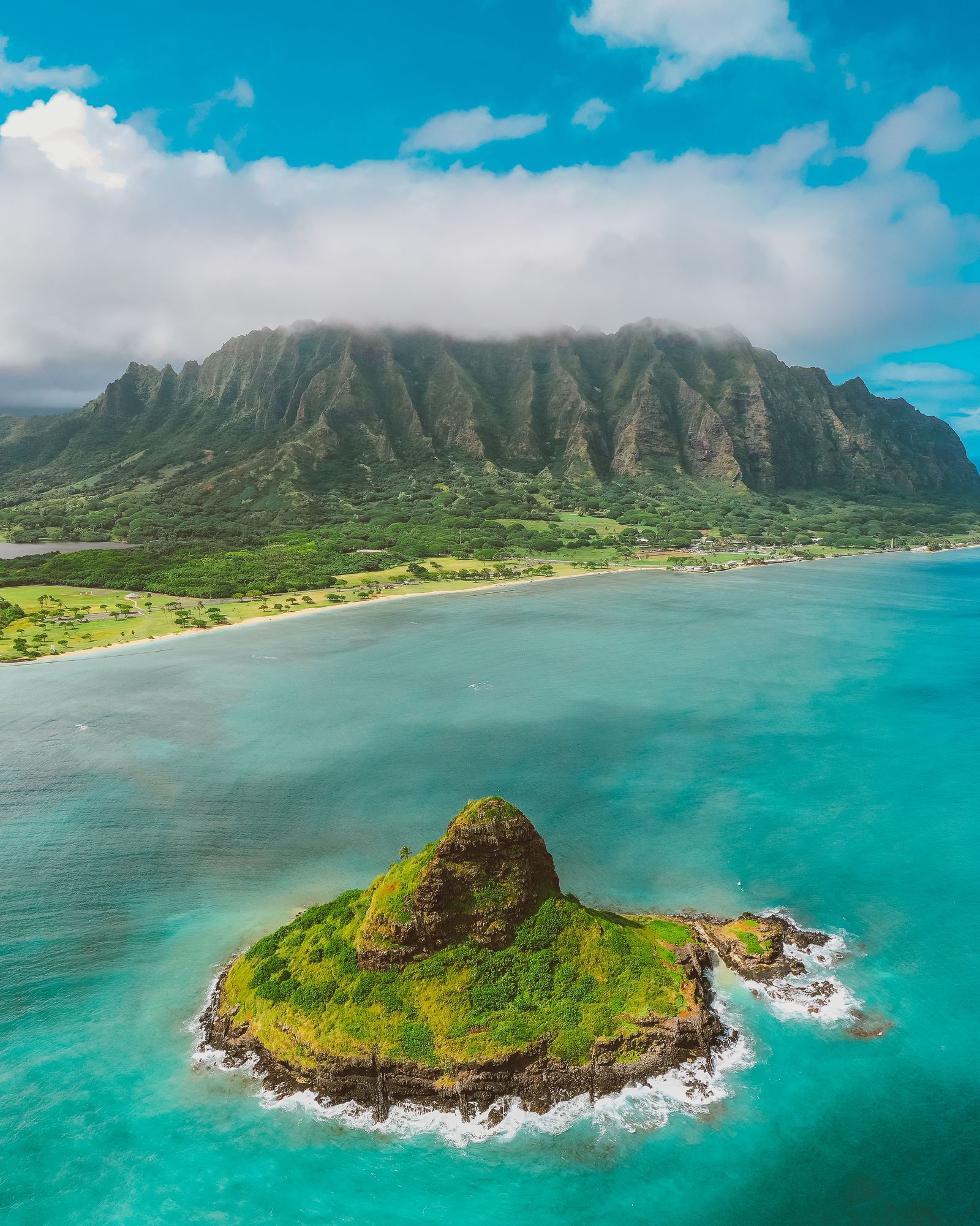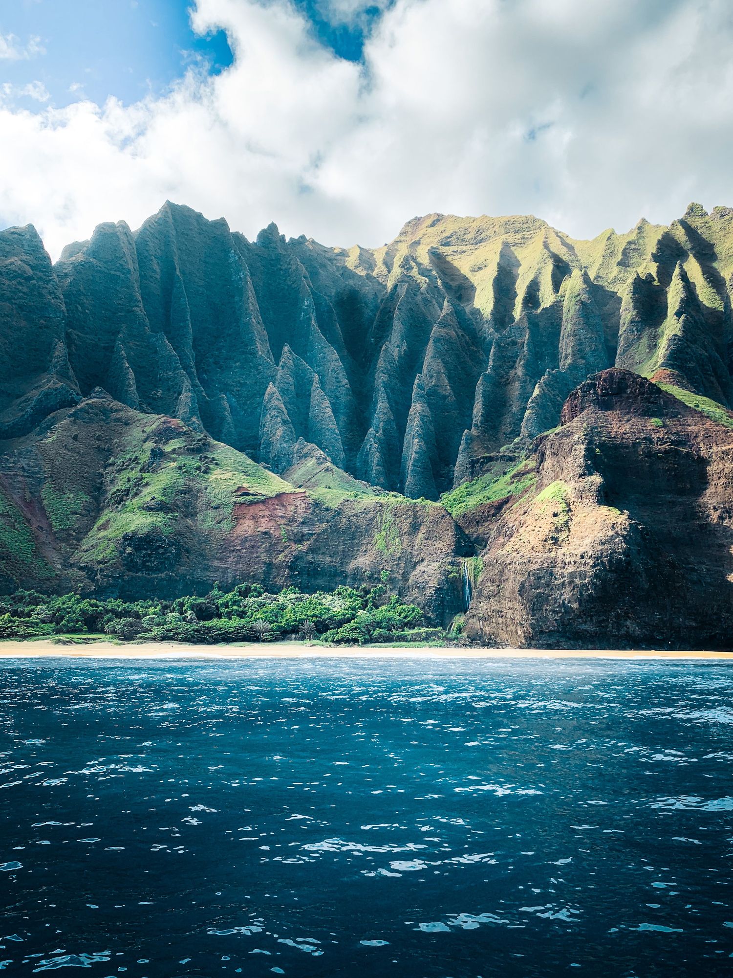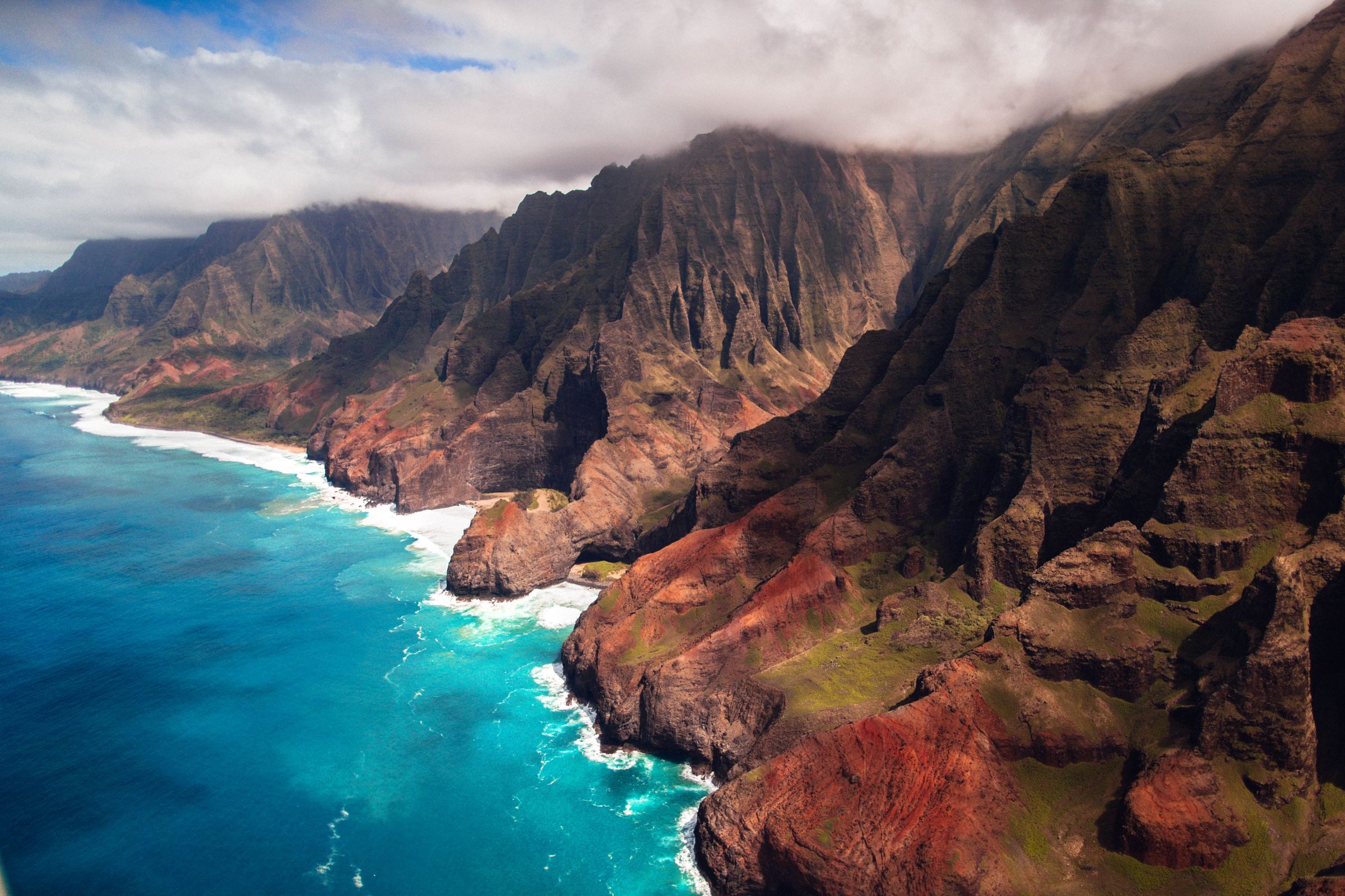
Kauaʻi is the oldest of the main islands, and millions of years of rain have carved it into knife-edge ridges, hanging valleys and a canyon ten miles long. It is the best hiking island in Hawaii, and also the most demanding. Here are 14 featured trails on one map, from a ten-minute canyon loop to the eleven miles of the Nā Pali coast.
Trail status · October 2026
Hurricane Lowell hit Kauaʻi in September 2026 and closed most state trails. Hāʻena State Park reopened on 15 October for day hikes to Hanakāpīʻai Beach and Falls (trails 1 and 2), but the Kalalau Trail beyond the two-mile mark and all Nā Pali camping remain closed. Kōkeʻe and Waimea Canyon state parks (trails 3 to 10) were still closed at the time of writing, and DLNR's forest-reserve trails on the east side had not fully reopened. Check Hawaiʻi State Parks and Nā Ala Hele before you plan a day around any of them.
Where are the best hikes on Kauaʻi?
Kauaʻi's trails cluster in three places. The north shore has the Kalalau Trail, the only way into the Nā Pali coast on foot. The west side has Kōkeʻe State Park and Waimea Canyon, a high plateau at 3,000 to 4,000 feet with cool air, rim trails and the edge of the Alakaʻi Swamp. The east side, around Wailua and Kapaʻa, has shorter ridge hikes in forest reserves that are easy to fit around a beach day.
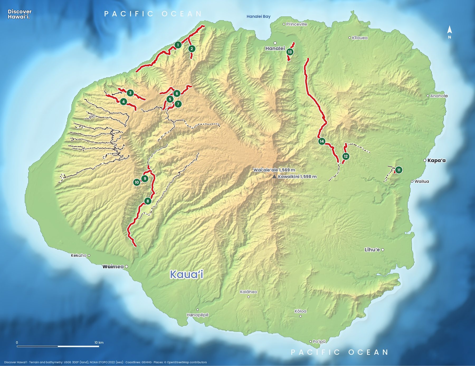
- Kalalau TrailDifficult11 mi (17.7 km) one way The Nā Pali coast trail to Kalalau Beach. A camping permit is needed past Hanakāpīʻai, plus a Hāʻena park reservation.
- Hanakāpīʻai FallsDifficult2 mi (3.2 km) from Hanakāpīʻai Beach A muddy valley trail with stream crossings to a 300-foot waterfall, 4 miles from the trailhead.
- Awaʻawapuhi TrailDifficult3.1 mi (5 km) one way Down a forested ridge to a cliff-top viewpoint high above the Nā Pali valleys.
- Nuʻalolo TrailDifficult3.8 mi (6.1 km) one way From Kōkeʻe to Lolo Vista, a narrow lookout above the Nā Pali coast.
- Pihea TrailModerate3.8 mi (6.1 km) one way Along the rim from the Kalalau Lookout, with the valley on one side and swamp forest on the other.
- Alakaʻi Swamp TrailDifficult3.5 mi (5.6 km) one way A boardwalk through a high mountain bog to the Kilohana lookout over Wainiha and Hanalei.
- Kawaikōī Stream TrailEasy1.8 mi (2.9 km) A quiet stream valley in the Kōkeʻe uplands.
- Waimea Canyon TrailModerate7 mi (11.3 km) Along the canyon floor beside the Waimea River.
- Kukui TrailDifficult2.5 mi (4 km) A steep descent of about 2,000 feet into Waimea Canyon, and the same climb back out.
- Iliau Nature LoopEasy0.3 mi (0.5 km) loop A short loop on the canyon rim past the rare iliau plant.
- Sleeping Giant (Nounou East)Moderate2 mi (3.2 km) A climb to the "giant's chest" with views over Wailua and the coast.
- Kuilau Ridge TrailModerate2.1 mi (3.4 km) A ridge walk from Keāhua Arboretum towards Waiʻaleʻale.
- ʻŌkolehao TrailModerate2.3 mi (3.7 km) A steep climb with views over Hanalei Valley and the bay.
- Powerline TrailDifficult11.2 mi (18 km) A long, muddy crossing of the island from Princeville to Wailua.
Can you hike the Kalalau Trail?
The Kalalau Trail (1) is one of the great coastal hikes in the world. It follows the Nā Pali cliffs for eleven miles from Kēʻē Beach to Kalalau Beach, dipping in and out of five valleys. Most people walk only the first two miles, to Hanakāpīʻai Beach, and many continue two more miles up the valley to Hanakāpīʻai Falls (2). Both are allowed with a day-use reservation for Hāʻena State Park, which non-residents must book in advance online. The shuttle from Waipā is the easiest way to get there.
Beyond Hanakāpīʻai you need a Nāpali Coast State Wilderness Park camping permit, even if you plan to walk back the same day. The trail narrows, crosses exposed cliff sections and gets slick after rain. Do not swim at Hanakāpīʻai Beach: there is no reef, the currents are strong, and the beach has a long history of drownings. In heavy rain the stream crossings become dangerous within minutes; if the water is rising, wait or turn back.
What are the best hikes in Kōkeʻe and Waimea Canyon?
Waimea Canyon is about ten miles long and roughly 3,000 feet deep, cut into the side of the old Kauaʻi shield volcano. The road climbs its western rim to Kōkeʻe State Park, where most of the island's classic day hikes begin.
Two trails drop from the Kōkeʻe plateau towards the Nā Pali coast: Awaʻawapuhi (3) ends at a cliff-top viewpoint with sheer drops on both sides, and Nuʻalolo (4) ends at Lolo Vista. Both are downhill on the way out and uphill all the way back, which catches many hikers out. Along the rim above Kalalau Valley, the Pihea Trail (5) joins the Alakaʻi Swamp Trail (6), a boardwalk across one of the highest bogs in the world to the Kilohana lookout. When the clouds lift, you can see all the way down to Hanalei Bay.
Inside the canyon itself, the Kukui Trail (9) drops steeply to the river and joins the Waimea Canyon Trail (8) along the canyon floor. It is a hot, full-day trip, and river crossings on this route were damaged in the 2026 hurricane.
Are there easy hikes on Kauaʻi?
Yes, three. The Iliau Nature Loop (10) is a ten-minute walk on the canyon rim, named after a plant related to Maui's silversword that grows almost nowhere else. The Kawaikōī Stream Trail (7) follows a cool, quiet stream through upland forest. For families, the first half-mile of the Kalalau Trail gives a big Nā Pali view without committing to the whole hike.
Where can you hike on the east side?
The east side is where Kauaʻi's residents hike after work. Sleeping Giant (11) is the mountain behind Kapaʻa that looks like a man lying on his back; the trail climbs to his chest for views over the Wailua River and the coast. The Kuilau Ridge Trail (12) starts at Keāhua Arboretum and runs along a green ridge towards the clouds of Waiʻaleʻale, one of the wettest places on Earth.
On the north shore, ʻŌkolehao (13) is a short, steep climb with the best view of the taro fields of Hanalei Valley. The Powerline Trail (14) follows a utility line right across the interior from Princeville to Wailua: eleven miles of mud, mainly for mountain bikers and very experienced hikers.
When is the best time to hike Kauaʻi?
Summer, from about May to September, is drier and the safest season for the north shore, when the surf at Hanakāpīʻai drops and streams are lower. Winter brings big north swells and more rain, but the west side often stays dry. Whatever the month, get to trailheads early: Kōkeʻe is clearest in the morning, and the Kalalau Trail and its parking fill up fast.
A few rules apply on every island. Start early, because clouds and rain build over the mountains by midday. Carry more water than you think you need, wear shoes with grip, and turn around if a stream is rising: flash floods in Hawaii can arrive with no rain where you are standing. Stay on the trail and off closed or private land, and leave rocks, plants and anything at heiau (temple sites) exactly where you found them.
For more on the island, see the Kauaʻi island guide and our Kauaʻi snorkel and dive map.
Facts checked October 2026. Trails close after storms, rockfalls and volcanic activity, so check the official status page and the weather before you go.
- Hawaiʻi State Parks: Hāʻena State Park
- Hawaiʻi State Parks: Kalalau Trail
- Hawaii News Now: Hāʻena State Park to reopen Oct. 15 after Hurricane Lowell closure
- Hawaii News Now: DLNR begins reopening select Kauaʻi lands
- Nā Ala Hele: Hawaiʻi Trail & Access System (DLNR)
- Map data: Hawaiʻi DLNR Nā Ala Hele trail system, U.S. National Park Service, USGS 3DEP, NOAA ETOPO 2022, GSHHG, © OpenStreetMap contributors