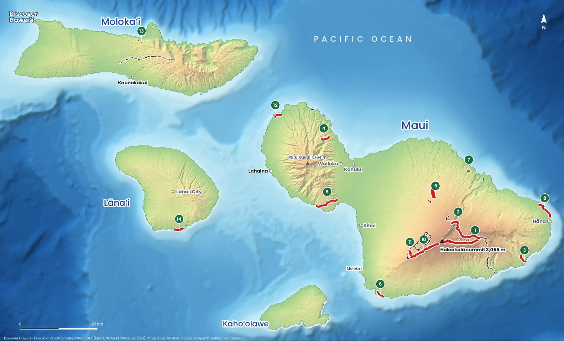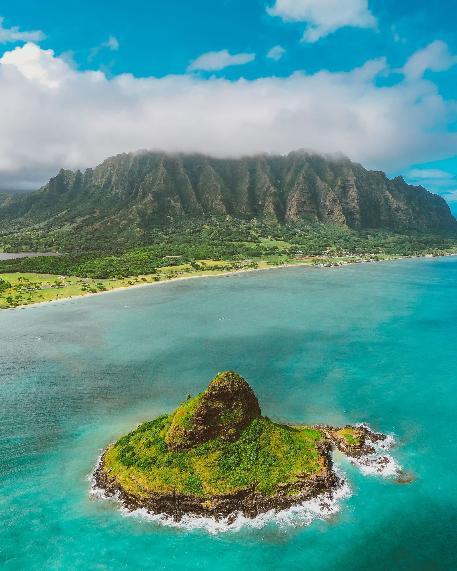
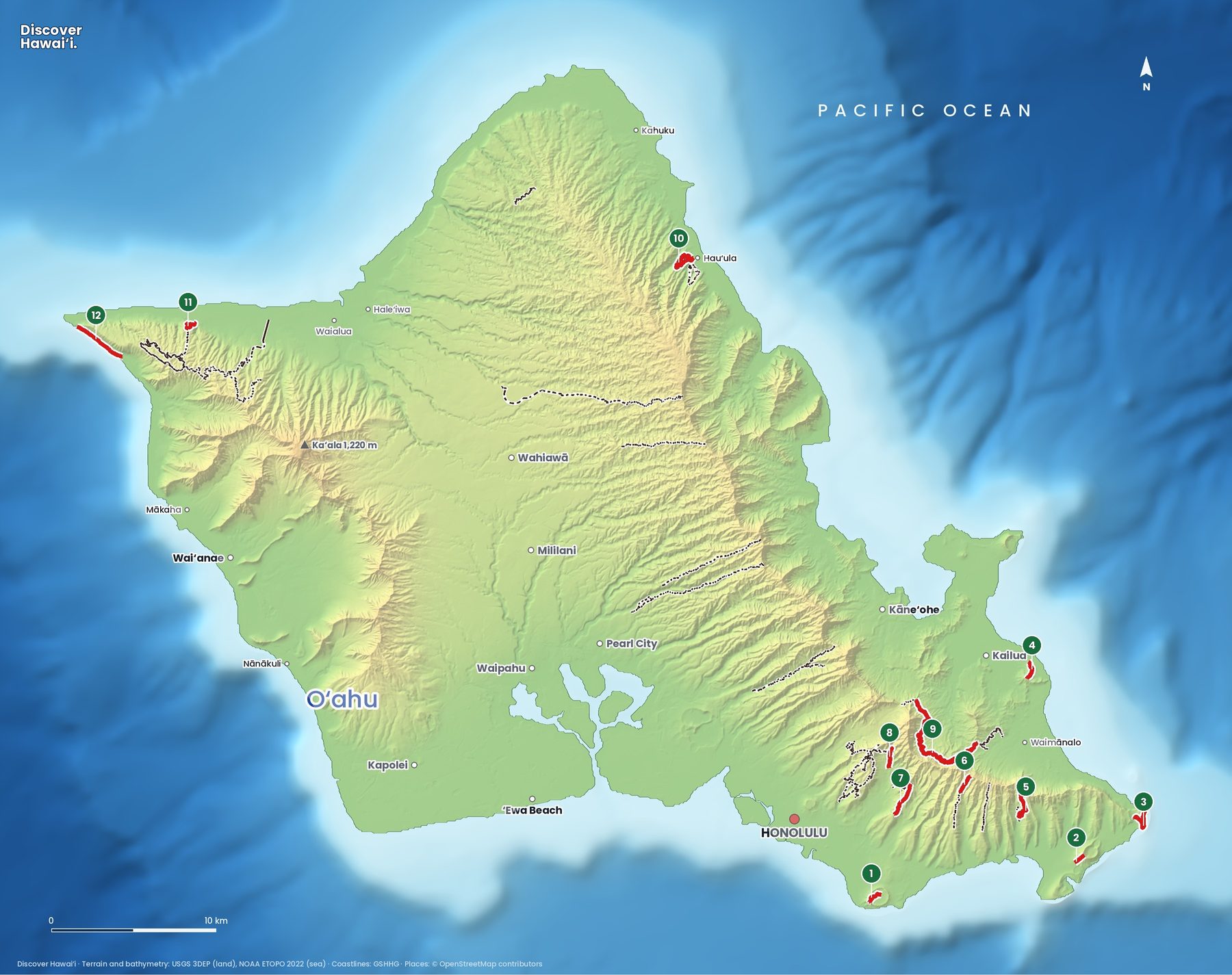
Oʻahu is the busiest island, but it hides some of Hawaii's best short hikes: a volcanic crater above Waikīkī, ridges that climb straight into the clouds of the Koʻolau mountains, and a wild coast at the island's western tip where albatross nest. Here are 12 featured trails on one map.
Trail status · October 2026
Most Oʻahu trails are open. Two on this map are not: the Keālia Trail (11) has been closed indefinitely since a landslide, and the Kaʻena Point trail from the Waiʻanae side (Keawaʻula) was closed in October 2026, though vehicle access to the area has reopened. Check Nā Ala Hele for the latest.
Where are the best hikes on Oʻahu?
Most of the featured trails are in the southeast, within half an hour of Waikīkī. Diamond Head, Koko Crater and Makapuʻu are short, sunny and dramatic. Behind Honolulu, a row of ridges runs up into the Koʻolau Range, with rainforest valleys between them. The windward side adds the Lanikai Pillboxes and the long Maunawili Trail, and the North Shore and west have quieter forest and coastal walks.
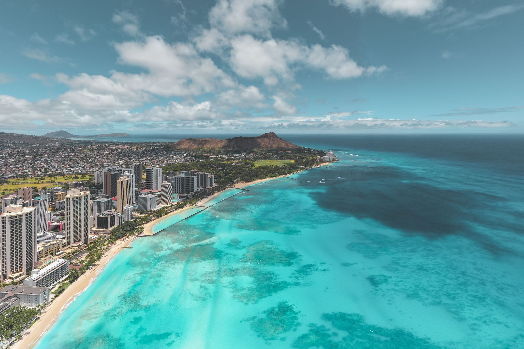
- Diamond Head Summit TrailModerate0.8 mi (1.3 km) one way Up the inside of the crater to the summit lookout over Waikīkī. Reservation needed for non-residents.
- Koko Crater StairsDifficult0.7 mi (1.1 km) About 1,000 old railway ties straight up the crater, with no shade.
- Makapuʻu Lighthouse TrailEasy1 mi (1.6 km) A paved path to the lighthouse lookout. Whales in winter.
- Kaʻiwa Ridge (Lanikai Pillboxes)Easy1 mi (1.6 km) A short, steep start to World War II bunkers above Lanikai Beach.
- Kuliʻouʻou Ridge TrailDifficult2.5 mi (4 km) Switchbacks and stairs to a Koʻolau summit.
- Wiliwilinui Ridge TrailModerate3 mi (4.8 km) A ridge to the Koʻolau crest.
- Waʻahila Ridge TrailModerate2.4 mi (3.9 km) A ridge between Mānoa and Pālolo valleys.
- Mānoa Falls TrailEasy0.8 mi (1.3 km) A rainforest walk to a 150-foot waterfall. Often muddy.
- Maunawili TrailModerate10 mi (16.1 km) A long contour trail under the Koʻolau cliffs, from the Pali to Waimānalo.
- Hauʻula Loop TrailEasy2.5 mi (4 km) loop A forest loop with ocean views on the windward coast.
- Keālia TrailModerate2.5 mi (4 km) North Shore cliff switchbacks above Dillingham Airfield.
- Kaʻena Point TrailEasy2.5 mi (4 km) A flat coastal walk to the wild western tip. No shade; seabirds and monk seals.
Do you need a reservation for Diamond Head?
Yes, if you are not a Hawaii resident. Diamond Head (1) is a State Monument, and non-residents must book an entry time online in advance: entry is $5 per person, and parking is $10 per car. The trail is only 0.8 miles each way, but it climbs about 560 feet through switchbacks, stairs and a tunnel to old military lookouts on the crater rim. Go at opening time (6 am) for cooler air and the best light over Waikīkī.
Nearby, the Koko Crater Stairs (2) are Oʻahu's hardest short workout: about 1,000 steps on an old World War II tramway, straight up the side of a crater, with nothing to hide behind from the sun. The view of Hanauma Bay at the top is the reward. A gentler option on the same coast is the paved Makapuʻu Lighthouse Trail (3), where you can often see humpback whales from December to April.
What are the best ridge hikes on Oʻahu?
Oʻahu's ridge trails are the island's signature hikes. They start in quiet neighbourhoods behind Honolulu and climb narrow spines towards the Koʻolau summit, with valleys falling away on both sides. Kuliʻouʻou Ridge (5) is the classic: steady switchbacks through ironwood forest, then a final stretch of steep steps to a summit with views over Waimānalo and the windward coast. Wiliwilinui (6) and Waʻahila (7) are similar, with more up-and-down along the way.
On the windward side, Kaʻiwa Ridge (4), better known as the Lanikai Pillboxes, is short but steep and loose at the start, and the bunkers on top look straight down on the Mokulua islands. It starts in a residential street, so park legally and keep noise down. Ridge summits are often in cloud and the last sections can be narrow and muddy; turn around if the wind picks up or the trail gets slick.
Where can you hike to a waterfall on Oʻahu?
Mānoa Falls (8) is the easiest waterfall hike on the island, a short walk through rainforest at the back of Mānoa Valley, ten minutes from Waikīkī. It is often very muddy, and swimming under the falls is not allowed because of rockfall. For a long day out, the Maunawili Trail (9) contours along the base of the Koʻolau cliffs for ten miles, crossing streams and offering views of the windward coast; most people walk a section and come back.
What are the best easy hikes on Oʻahu?
The Makapuʻu Lighthouse Trail (3) is paved and suits almost everyone. The Hauʻula Loop (10) on the windward coast is a shady forest loop with occasional ocean views. At the far west end of the island, the Kaʻena Point Trail (12) follows an old railway bed along a wild, rocky coast to a protected reserve at the point, where Laysan albatross nest and Hawaiian monk seals haul out on the rocks. It is flat but completely exposed, so bring sun protection and plenty of water, and stay at least 50 feet from any seal. Check access first: the Waiʻanae-side trail was closed in October 2026.
Are the Haʻikū Stairs open?
No. The Haʻikū Stairs, the "Stairway to Heaven" in Kāneʻohe, are closed and entry is illegal; the City and County of Honolulu voted to remove them. They are not on our map for that reason. If you want the same kind of view, the legal ridge trails above give it to you without trespassing through private land.
A few rules apply on every island. Start early, because clouds and rain build over the mountains by midday. Carry more water than you think you need, wear shoes with grip, and turn around if a stream is rising: flash floods in Hawaii can arrive with no rain where you are standing. Stay on the trail and off closed or private land, and leave rocks, plants and anything at heiau (temple sites) exactly where you found them.
See the Oʻahu island guide, our Oʻahu snorkel and dive map and the list of Hawaii reservations to book ahead.
Facts checked October 2026. Trails close after storms, rockfalls and volcanic activity, so check the official status page and the weather before you go.
- Hawaiʻi State Parks: Diamond Head State Monument
- Hawaiʻi State Parks: Kaʻena Point State Park
- Hawaiʻi DLNR: Kaʻena Point Natural Area Reserve
- Nā Ala Hele: Hawaiʻi Trail & Access System (DLNR)
- NOAA Fisheries: Viewing marine wildlife in Hawaii
- Map data: Hawaiʻi DLNR Nā Ala Hele trail system, U.S. National Park Service, USGS 3DEP, NOAA ETOPO 2022, GSHHG, © OpenStreetMap contributors