Kīlauea has shaped the people of Hawaiʻi Island as surely as it has shaped the land. Here is its human history, from a deadly cloud in 1790 to the lava fountains of the 2020s.
November 1790: footprints in the ash
In November 1790 a chief named Keōua was leading his warriors and their families home to Kaʻū, past the summit of Kīlauea. He was at war with his cousin Kamehameha for control of Hawaiʻi Island. As the column crossed the desert south-west of the caldera, the volcano exploded. A scalding surge of ash, steam and gas raced across the land, and one company of travellers died where they stood.
Estimates of the dead range widely, from about 80 to more than 5,000. To many Hawaiians the disaster was a sign that Pele favoured Kamehameha, and within a year Keōua was dead and the island was Kamehameha's.
In 1919 the geologist Ruy Finch noticed human footprints preserved in hardened ash in the Kaʻū Desert, in an area called Keonehelelei, "the falling sands". Thomas Jaggar suggested in 1921 that they were left by Keōua's warriors, and the idea stuck. Later USGS research suggests most of the prints were made by ordinary people, many of them women and children, during the eruption or in daily travel, rather than by a marching army.
Pele's home
Long before geologists, Hawaiians explained Kīlauea through Pele, or Pelehonuamea, the goddess of volcanic fire. In the traditions retold by the National Park Service, she travelled from Kahiki down the island chain looking for a home, and finally settled in Halemaʻumaʻu crater, where many say she still lives. Her journey runs the same way the islands grew, from old to young.
Visitors traditionally made offerings before approaching the crater or picking its red ʻōhelo berries. That custom made headlines in December 1824, when the Christian chiefess Kapiʻolani walked to the crater's edge, ate ʻōhelo berries without an offering and prayed to the Christian God, to show she did not fear Pele. Missionaries celebrated the act as a turning point, but devotion to Pele never disappeared, and practitioners still bring chants and offerings to Halemaʻumaʻu today.
The first written description of the volcano came a year earlier. On 1 August 1823 the missionary William Ellis reached the caldera with Hawaiian guides and recorded the boiling lakes of lava he saw on its floor.
Jaggar and the volcano observatory
By the late nineteenth century, Kīlauea's lava lake was one of the world's great sights, and visitors stayed at Volcano House on the caldera rim. Scientists came too. Thomas A. Jaggar, a geologist from the Massachusetts Institute of Technology, argued that volcanoes should be watched continuously, not visited now and then after disasters.
In 1912, with money from the Whitney estate through MIT, he founded the Hawaiian Volcano Observatory (HVO). Its first seismographs sat in a cellar beside Volcano House. The US Geological Survey took the observatory over in 1924 and has run it ever since, apart from a spell under the National Park Service in the Great Depression. In 1948 HVO moved to Uwekahuna Bluff on the caldera rim, where it stayed until the 2018 collapse damaged its buildings.
The same push for protection led to the national park, created on 1 August 1916. Today's visitors owe a great deal to both: see our Hawaiʻi Volcanoes National Park guide.
1924: the blast of the century
In early 1924 magma drained rapidly from beneath the summit, and the lava pond in Halemaʻumaʻu dropped out of sight. Groundwater flashed to steam against the hot rock, and from 10 May, for 18 days, the summit shook with explosions. On 18 May the largest blast hurled boulders across the caldera rim; one block of about eight tonnes landed roughly 1 km (0.6 mi) from the centre of the crater.
That day a man named Truman Taylor went too close to the crater to take a photograph and was fatally injured by a falling block. The USGS counts him as the only person killed by eruptive activity in Hawaiʻi in the twentieth century. When the explosions ended, Halemaʻumaʻu measured about 960 m (3,150 ft) across and 400 m (1,300 ft) deep, close to the size it kept for decades.
1959–1960: Kīlauea Iki and Kapoho
On the evening of 14 November 1959 a fissure opened in Kīlauea Iki, the smaller crater just east of the main caldera. Over about five weeks it erupted in 17 episodes. In one, the fountain reached about 580 m (1,900 ft), the highest ever measured at Kīlauea. It was the first eruption watched with modern instruments, and a lake of lava filled the crater floor.
Weeks later, in January 1960, the magma broke out far down the East Rift Zone beside the village of Kapoho in lower Puna. Around 300 residents left, and by the end of the month most of the village, including its school, was buried. The Cape Kumukahi lighthouse was spared, although the homes beside it were not.
1983–2018: Puʻuʻōʻō and lower Puna
On 3 January 1983 fissures opened on Kīlauea's East Rift Zone. Few guessed that the eruption would last 35 years. Lava fountains built a cone named Puʻuʻōʻō, and flows later poured downhill to the sea. In 1990 they reached the coastal community of Kalapana and, by the end of the year, had buried its homes, store and church under 15–25 m (50–80 ft) of rock. Over its lifetime, the eruption covered 144 km² (55.6 sq mi), added 177 ha (439 acres) of new land and destroyed 215 structures, according to the USGS.
On 30 April 2018 the crater floor of Puʻuʻōʻō collapsed, and magma moved towards lower Puna. From 3 May fissures opened inside the Leilani Estates subdivision. By the time the eruption ended, it had destroyed 716 homes, according to Hawaiʻi County, and filled Kapoho Bay. At the summit, the draining magma caused the caldera floor to sink in stages by more than 500 m (1,600 ft), accompanied by more than 60,000 earthquakes.
| Year | Event |
|---|---|
| 1790 | Explosive eruption kills Keōua's travellers |
| 1912 | Hawaiian Volcano Observatory founded |
| 1924 | Summit explosions widen Halemaʻumaʻu |
| 1959 | Kīlauea Iki fountains reach 580 m (1,900 ft) |
| 1983–2018 | Puʻuʻōʻō eruption; Kalapana buried in 1990 |
| 2018 | Lower Puna eruption; summit collapse |
| 2024–2026 | Episodic fountaining in Halemaʻumaʻu |
The 2020s: water, then fire again
After 2018 the summit fell quiet, and in 2019 something never recorded before appeared: a lake of water at the bottom of Halemaʻumaʻu. On the night of 20 December 2020 lava broke through, and the water boiled away in about 90 minutes. A series of summit eruptions followed, slowly refilling the collapsed caldera.
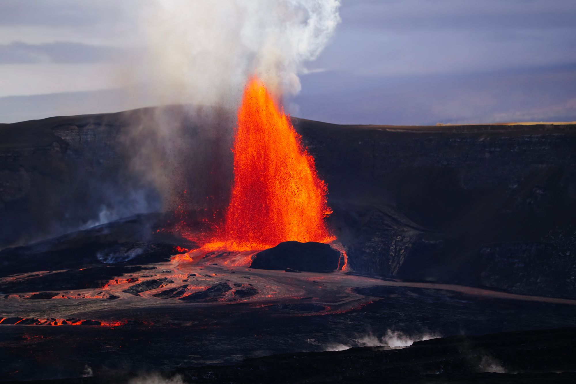
Since 23 December 2024 Kīlauea has erupted in short, spectacular episodes of lava fountaining inside Halemaʻumaʻu, separated by pauses of days or weeks. The USGS reports fountains up to about 480 m (1,575 ft), and by mid-October 2026 the count had reached 55 episodes. The eruption has already outlasted Kīlauea Iki and erupted roughly four times its volume.
Seeing Kīlauea's history today
Hawaiʻi Volcanoes National Park, about 45 minutes by car from Hilo, is open 24 hours a day. The volcano changes weekly, so check the USGS Hawaiian Volcano Observatory and the park website on the day you go.
- Kīlauea Iki Trail: a loop of about 6 km (4 mi) that crosses the solidified 1959 lava lake below the fountain site.
- Keonehelelei (the footprints area): reached by the Kaʻū Desert Trail; stay on the trail, as the ash is fragile.
- Halemaʻumaʻu overlooks: the best places to see fountaining when an episode is under way.
- Kalapana: outside the park, a short walk over the 1990 flows leads to a new black-sand shoreline.
Leave lava rock and offerings where they are, and treat the crater as the sacred place it is to many Hawaiians. Pair the park with Hilo, whose own brush with nature is told in the Hilo tsunamis of 1946 and 1960, and see our things to do on the Big Island. The volcano's place in the islands' story opens The History of Hawaii.
Quick answers
When did Kīlauea last erupt?
Kīlauea has erupted in repeated episodes of lava fountaining inside Halemaʻumaʻu crater since 23 December 2024; episode 55 took place on 17 October 2026. Check the USGS Hawaiian Volcano Observatory for the current status.
What was the deadliest eruption of Kīlauea?
The explosive eruption of November 1790, which caught part of the chief Keōua's travelling party in a surge of hot ash and gas. Estimates of the dead range from about 80 to more than 5,000.
How long did the Puʻuʻōʻō eruption last?
About 35 years, from 3 January 1983 to 30 April 2018. It covered 144 km² (55.6 sq mi) with lava and buried the village of Kalapana in 1990.
Who founded the Hawaiian Volcano Observatory?
The MIT geologist Thomas A. Jaggar founded it in 1912 on the rim of Kīlauea. The US Geological Survey has run it since 1924.
Is Pele still important in Hawaiʻi?
Yes. Many Native Hawaiians honour Pele as the goddess of the volcano who lives in Halemaʻumaʻu, and practitioners still bring chants and offerings to the crater.
Facts checked October 2026 against the sources below and the research for our book The History of Hawaii. Dates and figures for early Hawaiian history are estimates and scholars still debate some of them.
- Keonehelelei: the story of the Footprints area (National Park Service)
- Volcano Watch: Footprints in Kaʻū were probably made in 1790, not by Keōua's party (USGS)
- Study of Kīlauea's 1924 explosive eruption resembles a CSI (USGS)
- Volcano Watch: A look back on the episodic Kīlauea Iki eruption in 1959 (USGS)
- 1960 Kapoho eruption provided a lesson in Kīlauea behaviour (USGS)
- The Puʻuʻōʻō eruption lasted 35 years (USGS)
- Changes since 2018: Kīlauea summit caldera collapse and refilling (USGS)
- Photo and video chronology: Kīlauea summit episode 55 (USGS)