For half a century the US military used Kahoʻolawe as a target. A small group of young Hawaiians landed on it in 1976, and their campaign turned a bombing range into a place of healing.
4 January 1976: a landing on a forbidden shore
Early on 4 January 1976 a small flotilla of boats left Māʻalaea Harbor on Maui and headed for the dry, red island on the horizon. A Coast Guard helicopter warned them off, and most of the boats turned back. One kept going, and nine people waded ashore on Kahoʻolawe, an island the US Navy had been shelling for 35 years.
They were Walter Ritte, Noa Emmett Aluli, George Helm, Kimo Aluli, Gail Kawaipuna Prejean, Ellen Miles, Ian Lind, Steve Morse and Karla Villalba, remembered today as the Kahoʻolawe Nine. Federal marshals picked up six of them that day. Helm had already left to play an evening concert, while Ritte and Aluli slipped away inland and stayed at large for several days.
Ritte later recalled seeing painted circles around ancient stone sites, which he took for bombing targets. That image, of a people's history being used for target practice, became the spark for one of the defining campaigns of the Hawaiian Renaissance.
Kanaloa's island
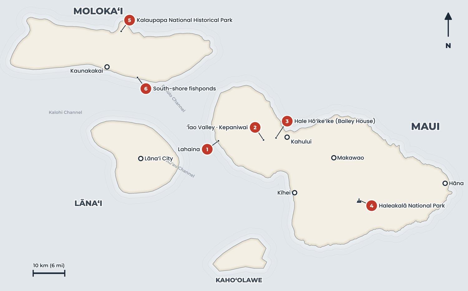
Kahoʻolawe is the smallest of the eight main Hawaiian islands, about 116 km² (45 sq mi) of wind-scoured slopes rising to 452 m (1,483 ft) at Puʻu Moaʻulanui. It sits in the rain shadow of Haleakalā and was never lush, yet people lived here for centuries in small coastal fishing settlements. Surveys have recorded nearly 3,000 archaeological and historic sites and features: house sites, shrines, fishing shrines called koʻa, petroglyphs and an adze quarry.
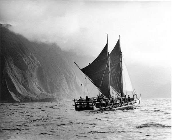
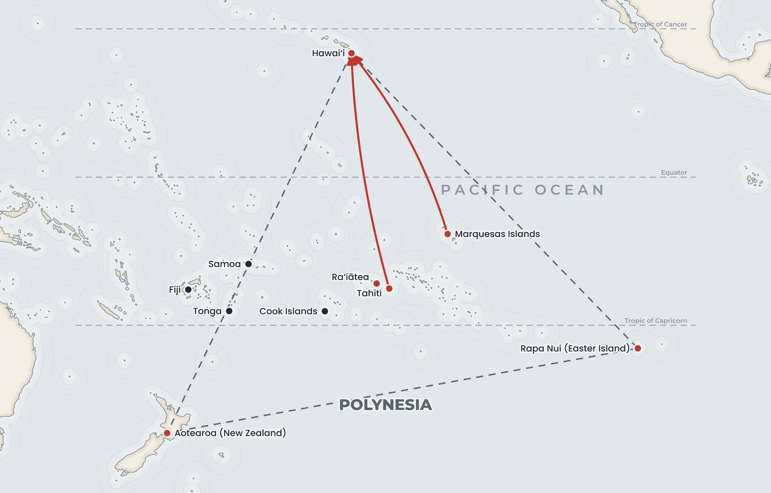
In tradition the island is linked to Kanaloa, god of the ocean, and one of its old names is Kohemalamalama o Kanaloa. Its south-western tip, Kealaikahiki, means "the path to Tahiti". From here, voyagers are said to have set their course south for the ancestral homeland, which is why the point still matters to navigators. The story of those voyages is told in how the Polynesians discovered Hawaiʻi.
Goats, sheep and a place of exile
The damage began long before the bombs. Goats were landed in the 1790s, and in the 1830s the kingdom used the island as a place of exile for convicts. From 1858 the government leased Kahoʻolawe for ranching, and by the late 1890s it carried roughly 900 cattle and 15,000 sheep, according to the Kahoʻolawe Island Reserve Commission (KIRC).
Overgrazing stripped the vegetation, and the trade winds carried the topsoil away in red clouds that could be seen from Maui. Large parts of the island were reduced to hardpan, a crust of bare subsoil that rain simply runs off. Ranching continued, in a struggling way, until the Second World War.
A target island, 1941–1990
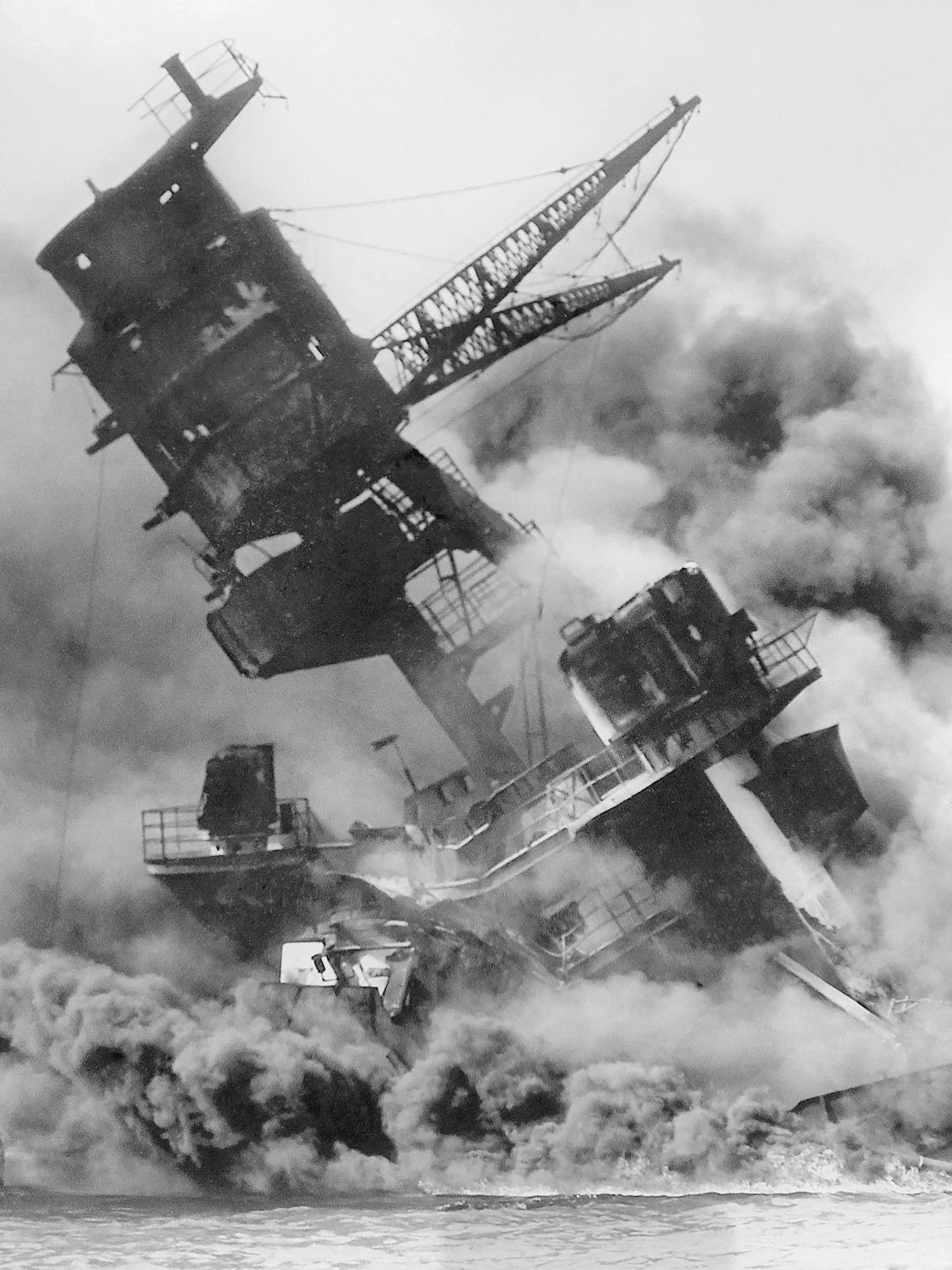
In May 1941 the US Army leased part of the island from the ranch for one dollar a year. After the attack on Pearl Harbor and the declaration of martial law, the military took over all of it. Warships practised ship-to-shore gunnery, submarines fired torpedoes at the cliffs, and aircraft rehearsed the bombing runs they would fly across the Pacific.
In 1953 President Dwight D. Eisenhower placed the island under the Navy, with a condition that it be returned in a condition suitable for habitation once it was no longer needed. The shelling went on through the Korean and Vietnam wars. In 1965, in a series of tests called Operation Sailor Hat, the Navy set off charges of 500 tons of TNT on the shore to simulate the effects of nuclear blasts on warships, leaving a large crater on the coast.
For many Native Hawaiians the island became a symbol of everything lost since the overthrow: land taken, sacred places ignored, and decisions made far away.
The ʻOhana and the price it paid
From the January landing grew the Protect Kahoʻolawe ʻOhana (PKO), a family of activists rather than a formal organisation. It gave modern voice to aloha ʻāina, love of and duty to the land, and it mixed protest with chant, ceremony and research. Members held a first ceremony to re-sanctify the island in February 1976 and filed suit in federal court.
The landings continued, and so did the arrests. Ritte, his wife Loretta and others occupied the island again and served time in prison. In 1977 a federal court ordered the Navy to prepare an environmental impact statement and to protect historic sites.
That year also brought tragedy. In early March 1977 George Helm, the PKO's president and a gifted falsetto singer, set out for the island with Kimo Mitchell and Billy Mitchell to support two friends who were occupying it. Their boat failed them, and the men tried to paddle back on surfboards in rough seas. Billy Mitchell survived; Helm, 26, and Kimo Mitchell, 25, were never found. Their loss turned a protest into a cause that the movement vowed never to abandon. Half a century later, Ritte summed up the spirit of the campaign in a single line: "There is no more powerful weapon than aloha."
From consent decree to handover
The legal pressure worked slowly. A consent decree between the Navy and the PKO in 1980 required soil conservation, replanting and the removal of goats, and allowed regular access for cultural use. In 1981 the whole island was listed on the National Register of Historic Places. From 1982 the ʻOhana held an annual Makahiki on the island, honouring the god Lono in public ceremony for the first time since the old religion was set aside in 1819 (see the end of the kapu system).
On 22 October 1990 President George H. W. Bush ordered the bombing to stop. Senator Daniel K. Inouye then secured legislation that ended military use, authorised the island's return to Hawaiʻi and set aside up to $400 million for removing unexploded ordnance. The Navy signed the island over to the state on 7 May 1994 and handed over control of access on 11 November 2003.
| Year | Milestone |
|---|---|
| 1941 | Military use begins |
| 1976 | First landing (4 January); PKO formed |
| 1980 | Consent decree opens regular access |
| 1990 | Bombing ends (22 October) |
| 1994 | Title passes to the State of Hawaiʻi (7 May) |
| 2003 | Navy hands over access control (11 November) |
Healing the land
The cleanup, which ended in 2004, cleared about three-quarters of the island's surface of ordnance, but only about a tenth to a depth of 1.2 m (4 ft). Roughly a quarter, some 2,700 ha (6,692 acres), is still unsafe without an escort.
Today the island is managed by the Kahoʻolawe Island Reserve Commission and held in trust until it can be transferred to a future Native Hawaiian sovereign entity. State law limits its use to cultural and spiritual practice, restoration, education and fishing. Volunteers plant native shrubs and grasses, build barriers to trap eroding soil and care for ancient sites. Navigators have built an observation platform at Kealaikahiki, and voyaging canoes have once again set out from its shore.
Seeing Kahoʻolawe today
There are no tours, ferries or casual landings, and the waters around the island are part of the reserve. You can still see it clearly from Maui's south shore: from the beaches of Kīhei, Wailea and Mākena, and from boats heading to Molokini, the island fills the horizon, glowing red at sunset.
- Volunteer access: KIRC and the PKO run restoration and cultural trips for people prepared to work, attend an orientation and follow strict safety rules.
- Learn on Maui: combine a south-shore sunset with our guide to things to do on Maui and the story of nearby Lahaina.
- Visit with care: read our advice on visiting Hawaiʻi respectfully; never land on the island or fish inside the reserve.
Kahoʻolawe's return is one of the few times a piece of land taken in the twentieth century came back to Hawaiian care. It sits alongside other unusual island histories, such as privately owned Niʻihau. The wider story of land, protest and revival is told in The History of Hawaii.
Quick answers
Can you visit Kahoʻolawe?
Not as a tourist. Access is controlled by the Kahoʻolawe Island Reserve Commission and limited to cultural, restoration and educational work, usually as an organised volunteer trip. Unexploded ordnance still makes parts of the island dangerous.
Why did the US Navy bomb Kahoʻolawe?
The military took over the island after the attack on Pearl Harbor in 1941 and used it for gunnery, bombing and torpedo practice. It remained a live-fire range through the Korean and Vietnam wars until bombing was halted on 22 October 1990.
Who were the Kahoʻolawe Nine?
The nine people who landed on the island in protest on 4 January 1976: Walter Ritte, Noa Emmett Aluli, George Helm, Kimo Aluli, Gail Kawaipuna Prejean, Ellen Miles, Ian Lind, Steve Morse and Karla Villalba.
What happened to George Helm?
George Helm, president of the Protect Kahoʻolawe ʻOhana, and Kimo Mitchell disappeared at sea in March 1977 while trying to reach the island. They tried to paddle back to Maui on surfboards and were never found.
When was Kahoʻolawe returned to Hawaiʻi?
The Navy conveyed the island to the State of Hawaiʻi on 7 May 1994 and handed over control of access on 11 November 2003. It is held in trust for a future Native Hawaiian sovereign entity.
Facts checked October 2026 against the sources below and the research for our book The History of Hawaii. Dates and figures for early Hawaiian history are estimates and scholars still debate some of them.
- History of Kahoʻolawe (Kahoʻolawe Island Reserve Commission)
- Kanaloa Kahoʻolawe timeline (Ka Wai Ola, OHA)
- 50 years ago, these Hawaiian activists landed on Kahoʻolawe to end military bombing (Hawaiʻi Public Radio)
- Ian Lind: Kahoolawe 40 years later (Civil Beat)
- 40 years after men's disappearance at sea, their vision for Kahoolawe has become a reality (Maui News)
- Kahoʻolawe: The Pacific's Battered Bullseye (National WWII Museum)