A gorge of red and green rock about 16 km long, cut into the oldest of the main Hawaiian islands. Here is how to see Waimea Canyon and Kōkeʻe State Park: the lookouts, the best hikes, the fees and the state of the road after Hurricane Lowell.
Reopening day
On Saturday 24 October 2026, the gate to the Waimea Canyon Lookout opened again. For six weeks the road had been shut. When Hurricane Lowell passed Kauaʻi on 7 to 8 September, it brought down so many trees on Waimea Canyon Drive and Kōkeʻe Road that the state posted officers at a round-the-clock roadblock, and people in about 100 leased cabins in Kōkeʻe had to wait for crews to cut them a way out. One state official described the damage in the forest as "unreal".
The reopening was partial. Only the main lookout was open, with parking fees but entry fees waived, while the higher lookouts, Kōkeʻe State Park and its trails stayed closed until further notice. This guide describes the canyon as it normally works, and flags what was open as of late October 2026. Check the Division of State Parks notices before you drive up.
What Waimea Canyon is
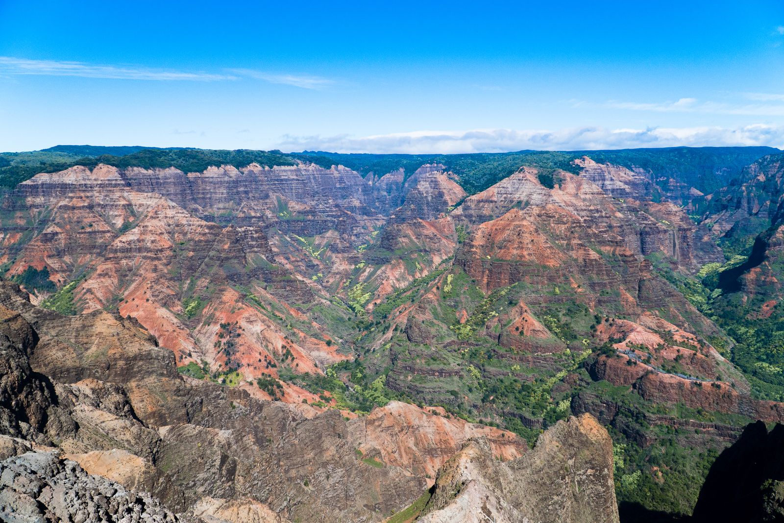
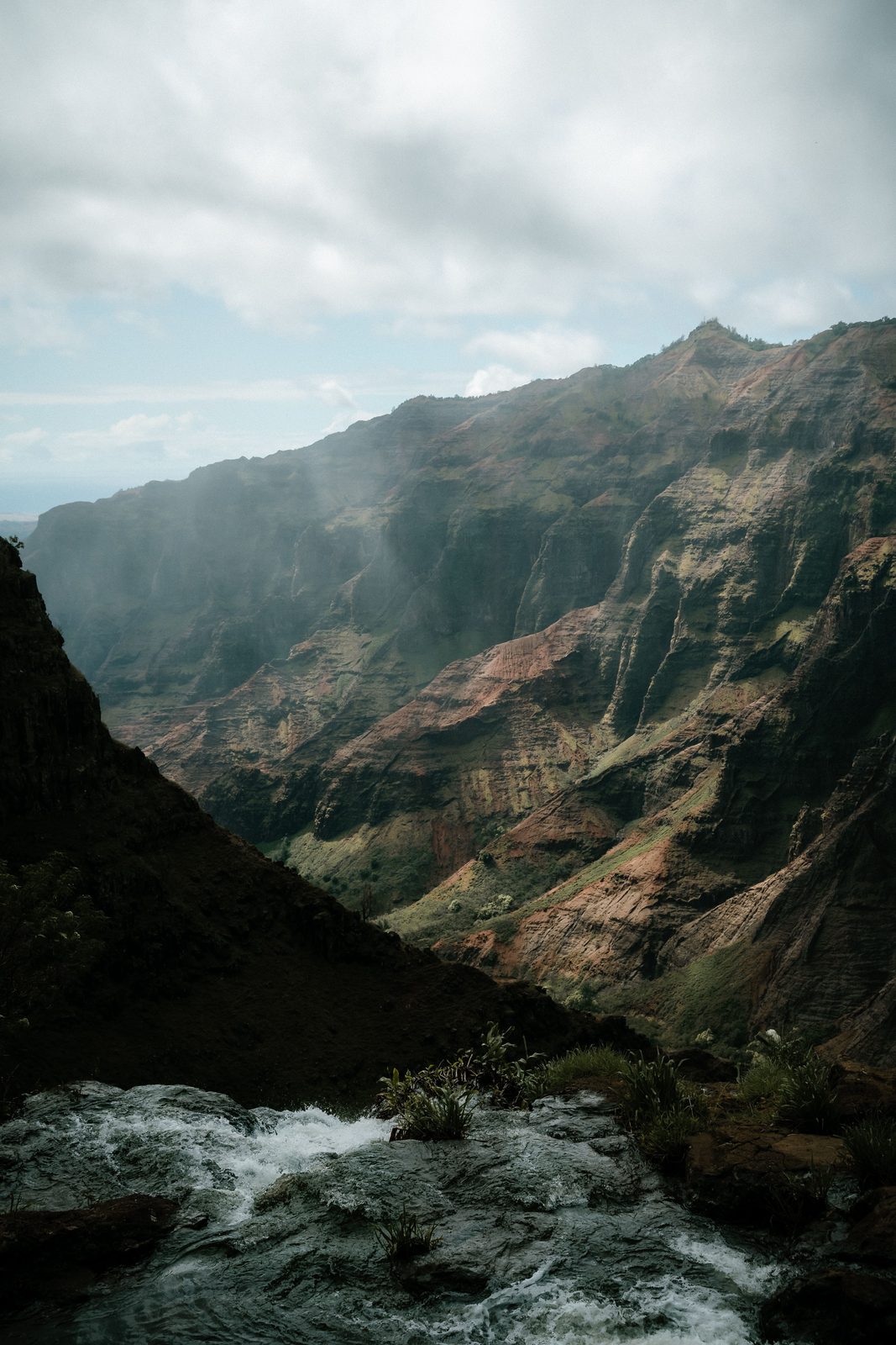
Waimea Canyon runs for about 16 km (10 miles) through the west of Kauaʻi and is commonly given as up to around 900 metres (3,000 feet) deep, with some sources quoting more. Its walls are layered red, rust, grey and green: old lava flows weathered into iron-rich soil, streaked with forest and the silver lines of waterfalls after rain.
It was carved by the Waimea River and its tributaries, which drain the wettest part of the island around Mount Waiʻaleʻale and the Alakaʻi Swamp, cutting down through the remains of Kauaʻi's ancient shield volcano. The river reaches the sea at Waimea town, where Captain Cook first landed in Hawaiʻi in January 1778, a story told in Captain Cook in Hawaii.
You will often read that Mark Twain called it "the Grand Canyon of the Pacific". That attribution is doubtful. Twain's 1866 travels in the islands took him to Oʻahu, Maui and Hawaiʻi Island, there is no record of him visiting Kauaʻi, and the phrase has not been traced to his writings. The nickname is real and old, but its author is unknown.
The lookouts, from bottom to top
The road climbs from sea level to over 1,200 metres (4,000 feet) along the canyon rim. Waimea Canyon Drive (from Waimea) and Kōkeʻe Road (from Kekaha) join on the way up; the lookouts come in this order.
| Lookout | What you see | Status, late Oct 2026 |
|---|---|---|
| Waimea Canyon Lookout | The classic wide view down the main canyon | Open, daylight hours |
| Puʻu Ka Pele | Canyon view; Waipoʻo Falls across the gorge | Closed |
| Puʻu Hinahina | Canyon to the sea; Niʻihau on clear days | Closed |
| Kalalau Lookout | Straight down into Kalalau Valley on the Nā Pali Coast | Closed with Kōkeʻe Road |
| Puʻu o Kila | Kalalau Valley and the edge of the Alakaʻi | Closed with Kōkeʻe Road |
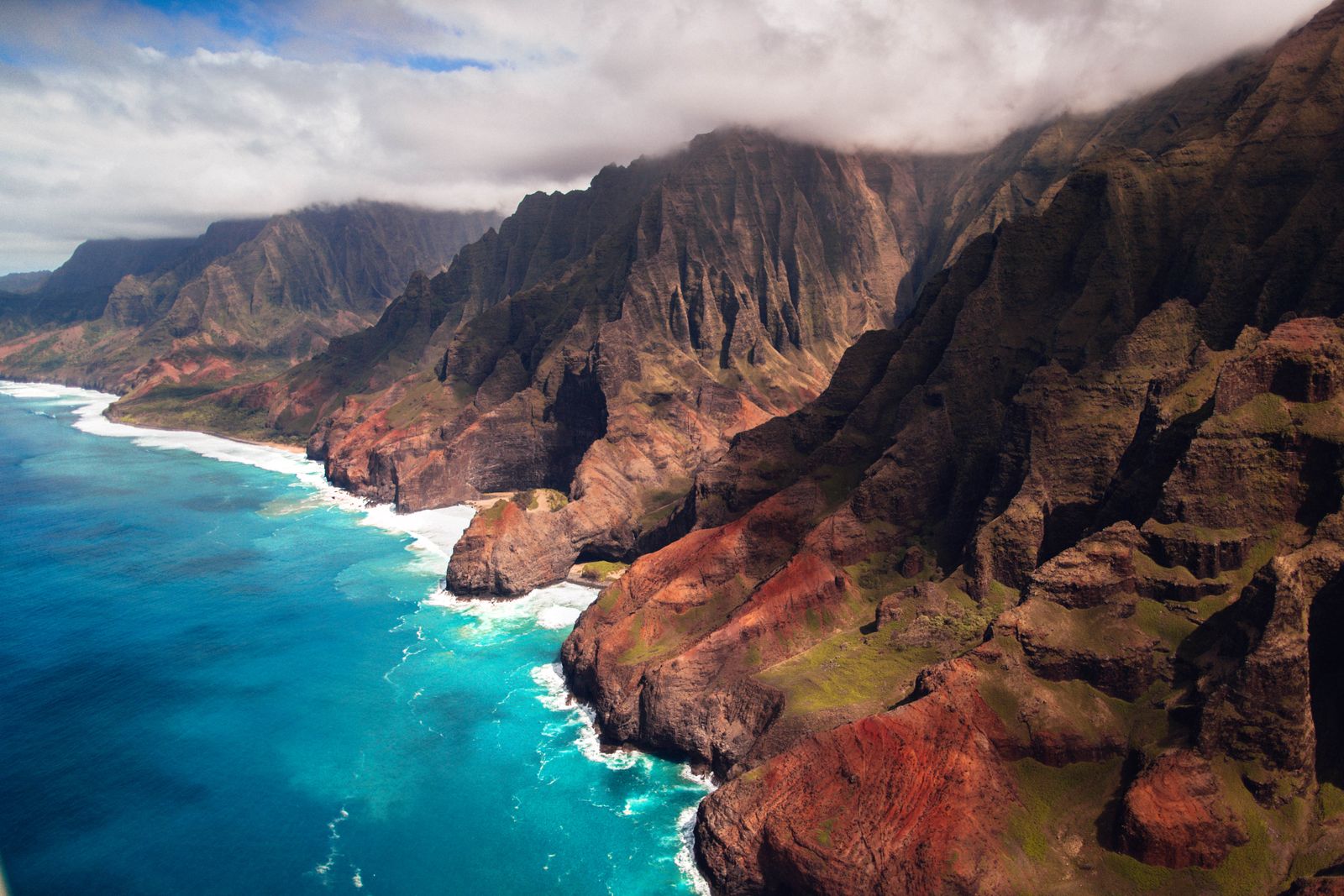
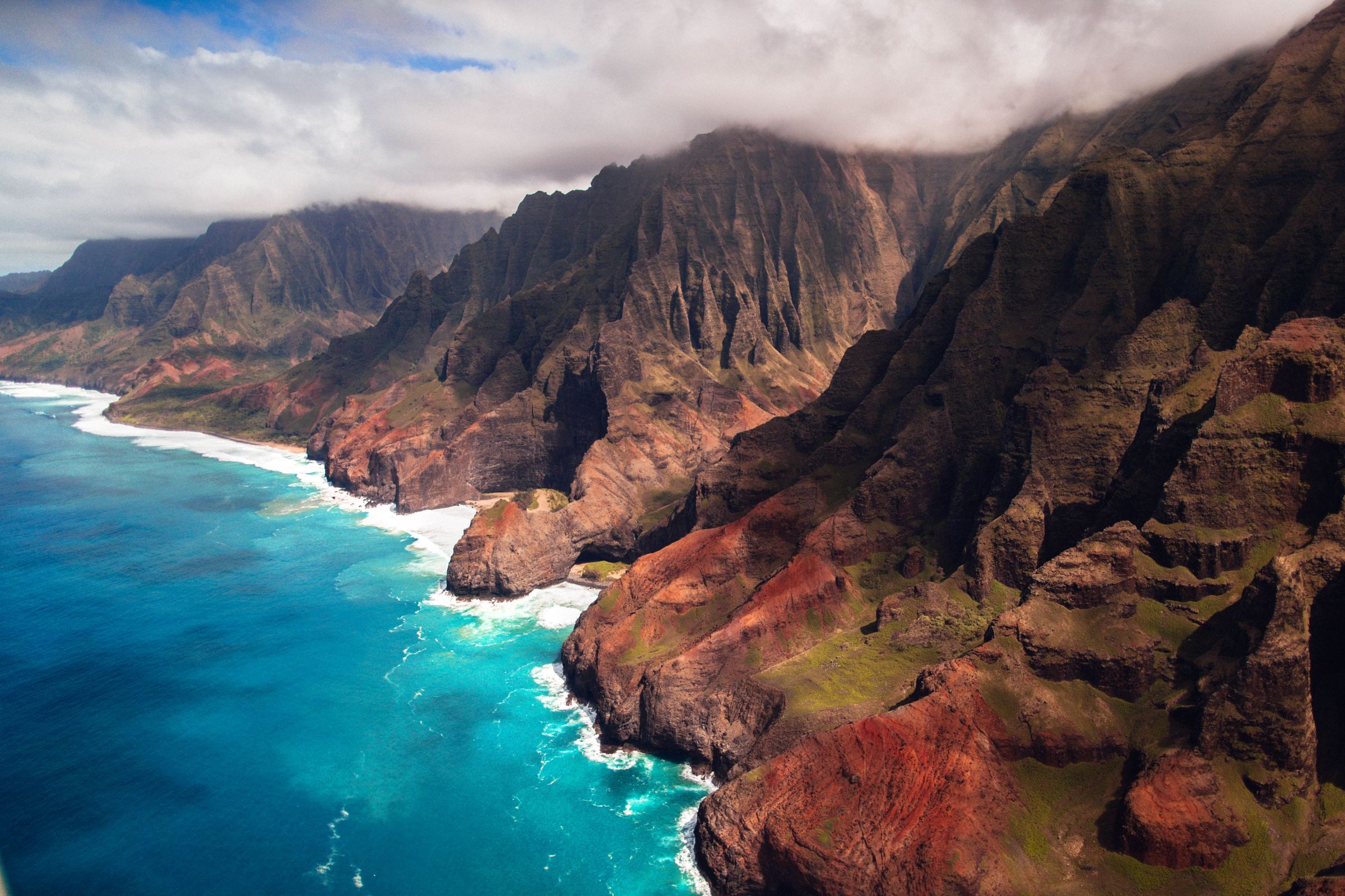
The two lookouts at the end of the road belong as much to the Nā Pali Coast as to the canyon: on a clear morning they are among the most spectacular views in Hawaiʻi.
Kōkeʻe: the forest at the top
Above the canyon, the road enters Kōkeʻe State Park, a cool upland of koa and ʻōhiʻa forest at around 1,100 metres (3,600 feet). It feels nothing like the beach: mist drifts through the trees, temperatures can fall to single figures Celsius at night, and the air smells of wet earth and eucalyptus planted in the twentieth century.
Kōkeʻe borders the Alakaʻi Swamp, a high plateau bog that is one of the last refuges for Kauaʻi's native forest birds, several of them critically endangered. You are unlikely to see the rarest ones, but listen for birdsong in the native forest and clean your boots before and after hiking so you do not carry weed seeds or plant disease from trail to trail. Rapid ʻōhiʻa death, a fungal disease, has reached Kauaʻi, and boot cleaning is one of the few ways visitors can help.
In normal times the park has a small natural history museum with trail maps and advice, a lodge and leased cabins. Hurricane Lowell brought down a great many trees here, so expect visible damage and changed facilities when it reopens.
Fees, parking and hours
Waimea Canyon State Park and Kōkeʻe State Park are open daily during daylight hours. Hawaiʻi residents enter and park free with a state ID or driver's licence. Non-residents normally pay:
- Entry: 5 dollars per person (children 3 and under free).
- Parking: 10 dollars per vehicle. One parking ticket is valid at both Waimea Canyon and Kōkeʻe car parks.
- Tours: commercial vehicles pay from 25 dollars, depending on size.
After the October 2026 reopening, only the parking fee was being charged at the Waimea Canyon Lookout. Camping in Kōkeʻe was also closed, partly for campground improvements planned to run into spring 2027. For other booking rules around the islands, see our Hawaii reservations guide.
Hikes: Waipoʻo Falls and beyond
Kōkeʻe and Waimea Canyon have around 45 miles (72 km) of trails, from short nature loops to steep descents into the canyon. All were closed in late October 2026 while crews cleared storm damage, but these are the classics for when they reopen.
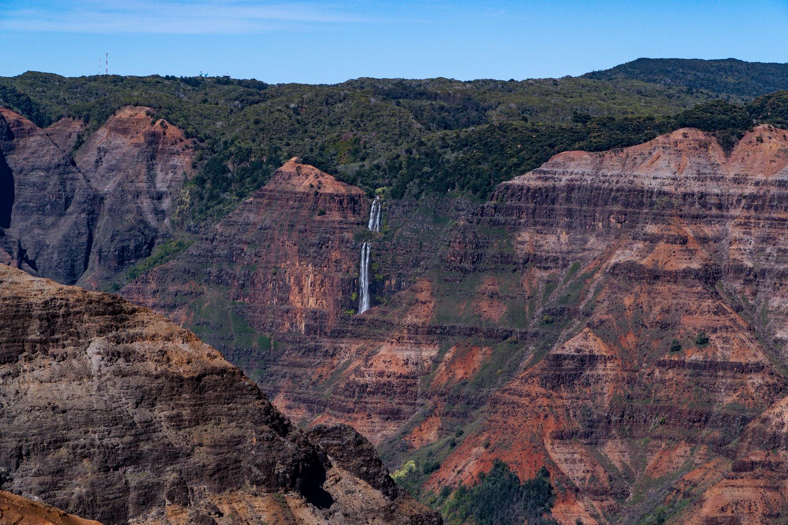
- Canyon Trail to Waipoʻo Falls: about 3.4 miles (5.5 km) return, moderate, with muddy switchbacks and exposed edges. It leads to the top of one tier of Waipoʻo Falls, which drops about 240 metres (800 feet) in several stages, and then to a rim viewpoint.
- Iliau Nature Loop: a short, easy loop near the start of the Kukui Trail, with canyon views and native plants.
- Kukui Trail: a steep, hot descent of about 600 metres (2,000 feet) to the Waimea River. The hard part is coming back up.
- Pihea and Awaʻawapuhi: ridge trails in Kōkeʻe with views over the Nā Pali valleys, often cloudy and very muddy.
You may also see social media posts about the Kalepa Ridge. It is not a state-managed trail: it is an unofficial route along a crumbling knife-edge, behind a fence posted "Trail Closed". Do not hike it. Our Kauaʻi hiking trails map shows the official alternatives.
When to go and how to stay safe
Go early. Clouds often fill the canyon and cover the Kalalau Lookout by late morning, and the light on the red walls is best before then. Allow about an hour each way from Waimea or Kekaha, more with stops. It is noticeably cooler at the top, so bring a warm layer and rain jacket, and fill up with fuel and food before you leave the coast.
- Stay behind railings. Canyon edges are loose and undercut; many viewpoints have no barrier at all.
- Treat red mud with respect. Trails turn to grease after rain; turn back rather than slide.
- Watch for closures. After a hurricane, fallen trees and unstable slopes can remain hidden for months.
- Drive with care. The road is narrow and winding, with tour vans and cyclists.
Nearby: Waimea town and the west side
Waimea town, at the bottom of the canyon road, has places to eat and a Cook statue marking his 1778 landing. The west side was among the hardest-hit areas in Hurricane Lowell: the Waimea pier was largely destroyed and the coastal highway near Kekaha was badly washed out, so check road conditions with the state transport department. Polihale State Park and the Russian fort site at Pāʻulaʻula were closed in October 2026.
Pair the canyon with a Nā Pali boat tour or helicopter flight, and see things to do on Kauaʻi for ideas across the island. If the weather closes in, our rainy-day Kauaʻi guide has alternatives.
Quick answers
How much does it cost to visit Waimea Canyon?
Non-residents normally pay 5 dollars per person entry and 10 dollars per vehicle for parking, with one parking ticket valid at Waimea Canyon and Kōkeʻe. Hawaiʻi residents enter free with ID. After the October 2026 reopening only the parking fee was being charged.
Is Waimea Canyon open after Hurricane Lowell?
Partly. The Waimea Canyon Lookout reopened on 24 October 2026, during daylight hours. The higher lookouts, Kōkeʻe State Park, its trails and Kōkeʻe Road remained closed until further notice.
Did Mark Twain call Waimea Canyon the Grand Canyon of the Pacific?
Probably not. The phrase is often credited to him, but his 1866 visit to the islands covered Oʻahu, Maui and Hawaiʻi Island, there is no record of him on Kauaʻi, and the quote has not been found in his writings.
What is the best hike in Waimea Canyon?
The Canyon Trail to the top of Waipoʻo Falls, about 3.4 miles (5.5 km) return, gives the best mix of canyon views and a waterfall. It is moderate but muddy after rain. Check that it has reopened before you go.
How long does it take to drive to Waimea Canyon?
Allow about an hour from Waimea or Kekaha to the Kalalau Lookout at the top, without stops, and around 30 to 40 minutes to the Waimea Canyon Lookout. From Līhuʻe or Poʻipū add another hour.
Facts checked October 2026. Reservations, fees, opening hours and trail or road closures change often in Hawaii, so confirm with the official source before you go.
- DLNR Division of State Parks: Waimea Canyon State Park
- DLNR Division of State Parks: Kōkeʻe State Park
- The Garden Island: Waimea Canyon Lookout reopened Saturday
- Hawaii News Now: DLNR lands on Kauaʻi closed for foreseeable future due to storm damage
- Hawaii Guide: Waipoʻo Falls
- To-Hawaii: Waimea Canyon State Park
- Civil Beat: Hurricane Lowell hit Kauaʻi hard but worst fears averted